A Day on the Mountain
Happy weekend, friends! Or, maybe happy second half of the weekend?
Today’s post is a goodie – a guest post by the Fab Hub! No, he’s not going to walk you through the process of making his Oregano Chicken…but he will walk you through his guys’ day hike at our favorite hiking spot recently. Follow along with the Fab Hub, check out the gorgeous photos, and see how he spent his day while Zilla and I were home doing nothing together.
Please welcome the Fab Hub and leave him some love in the comments. Oh, and if you want him to make that Oregano Chicken…tell him!
It was 8:15 AM. I parked my car in the very empty lot at the Hawk Mountain Sanctuary Visitor Center (#1 on the map) where I was to meet up with Intrepid Friend to begin our 6+ mile hike along the trails in the sanctuary. After applying bug spray & sun screen, and prepping our backpacks, we approached the trailhead at about 8:45.
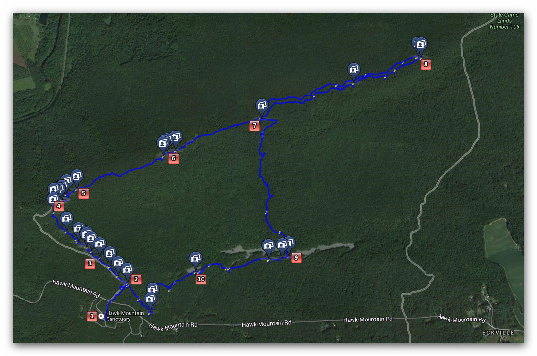
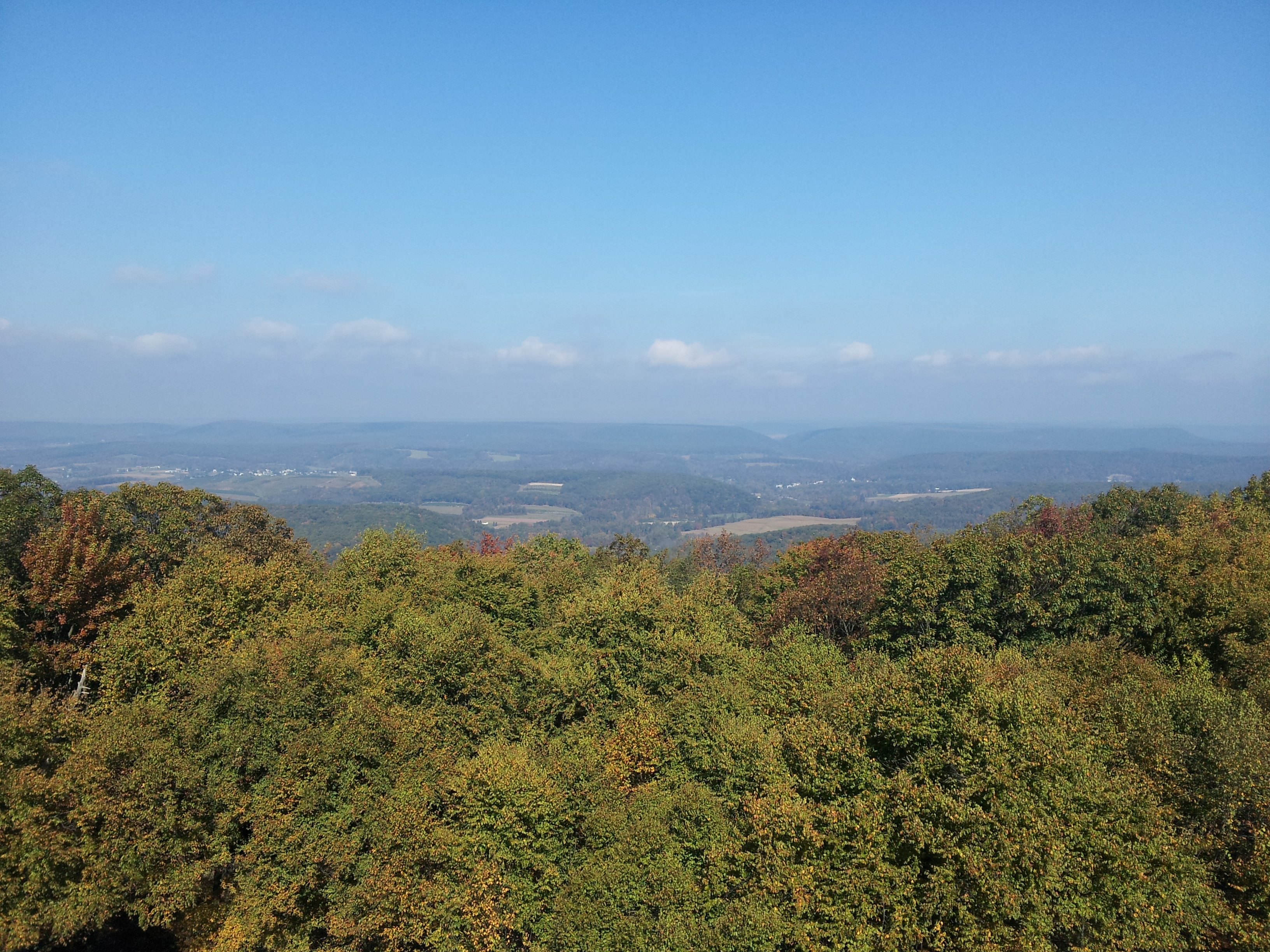
The first and shortest leg of our trip brought us to the South Lookout (2), a very popular birding spot as well as a nice scenic overlook. From here, there is a lovely view of the kettle (the lowland area in between the north and south ridges, along the center of which runs the river of rocks), and on a clear day (like in the photo of the random guy here) the river is much more visible than it was that morning in this photo (though you can just about see the grey break in the trees in the center):
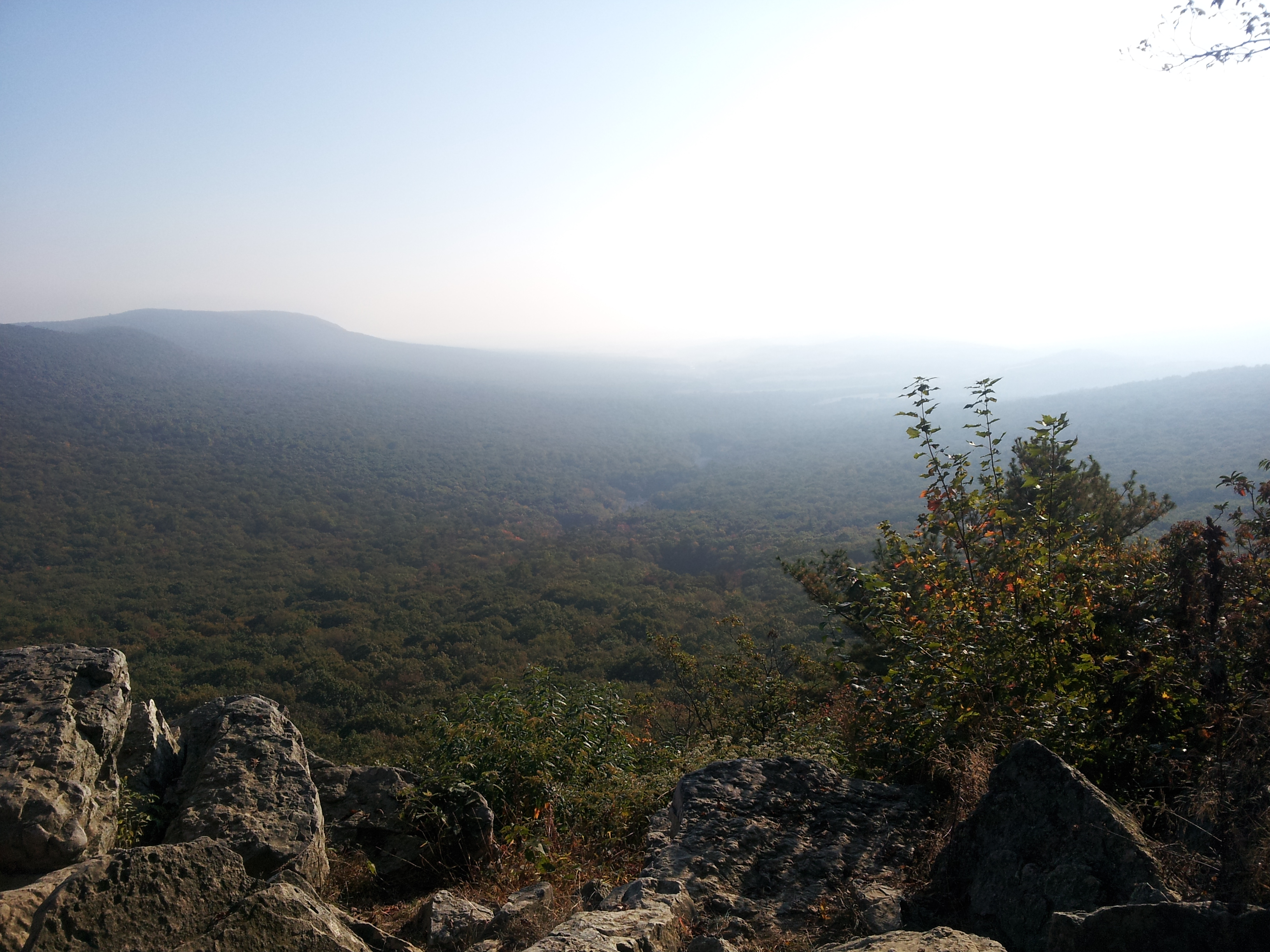
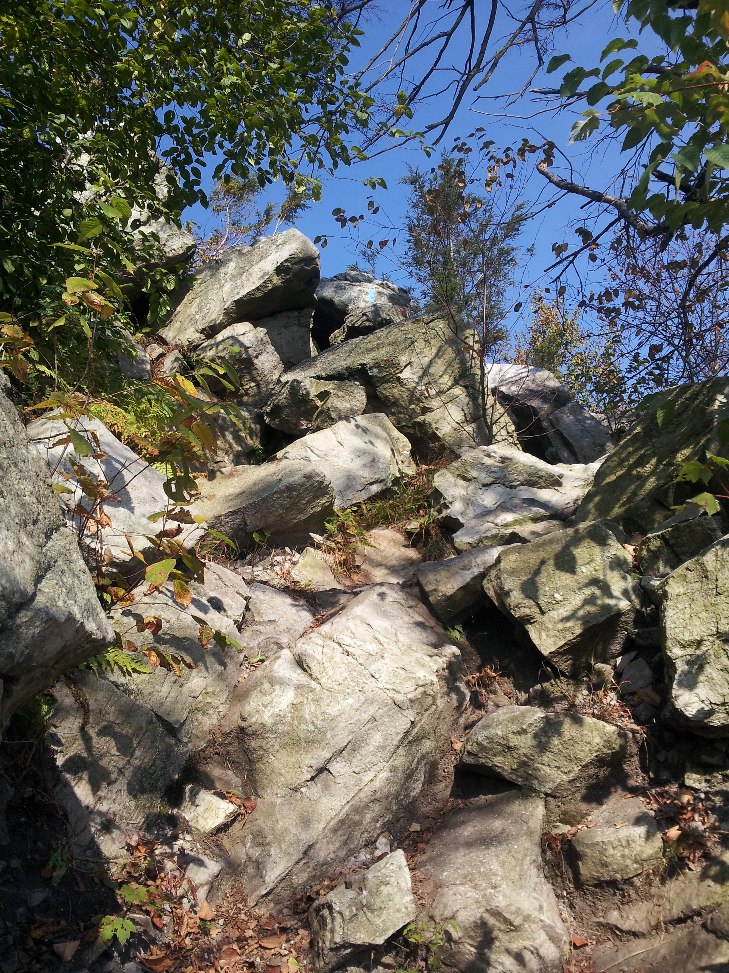
From the South Lookout, we travelled northwest along the Lookout Trail and made absolutely poor time, because I insisted on stopping at each of the 4 overlooks along the trail to take some pictures. Just after the 4th overlook, we approached the Escarpment Trail, a spur that runs a bit more steeply up the mountain (while the Lookout Trail loops around to the west a bit more and lends itself to being a slightly more leisurely climb). This Escarpment Trail (3) is also peppered with medium to large boulders that require some scrambling and scaling to ascend:
However, the added challenge leads to some spectacular views of the kettle that are inaccessible from the Lookout Trail. Ultimately, the Escarpment and Lookout Trails reconnect just before the North Lookout (4), which is the premier destination in the sanctuary.
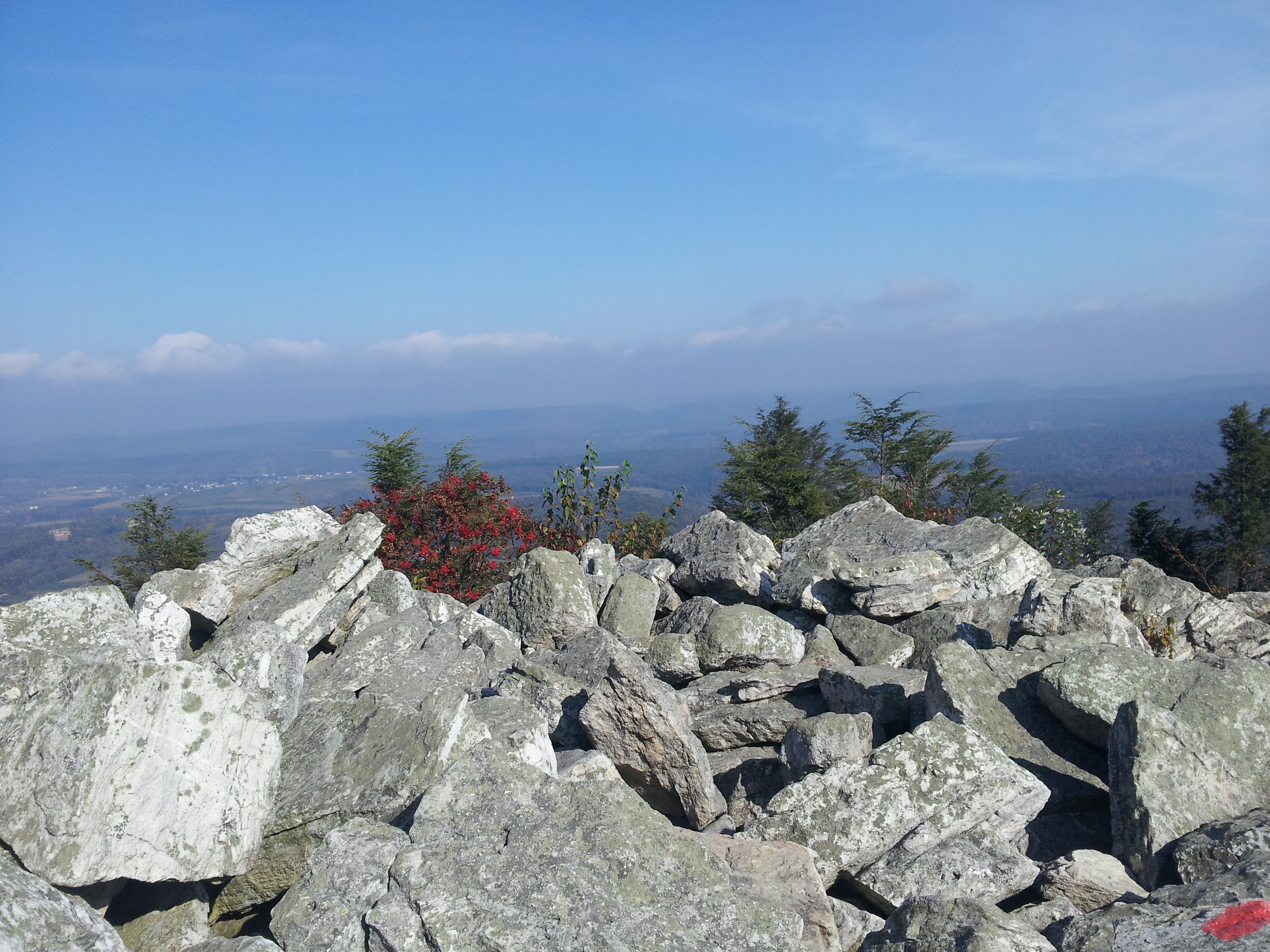
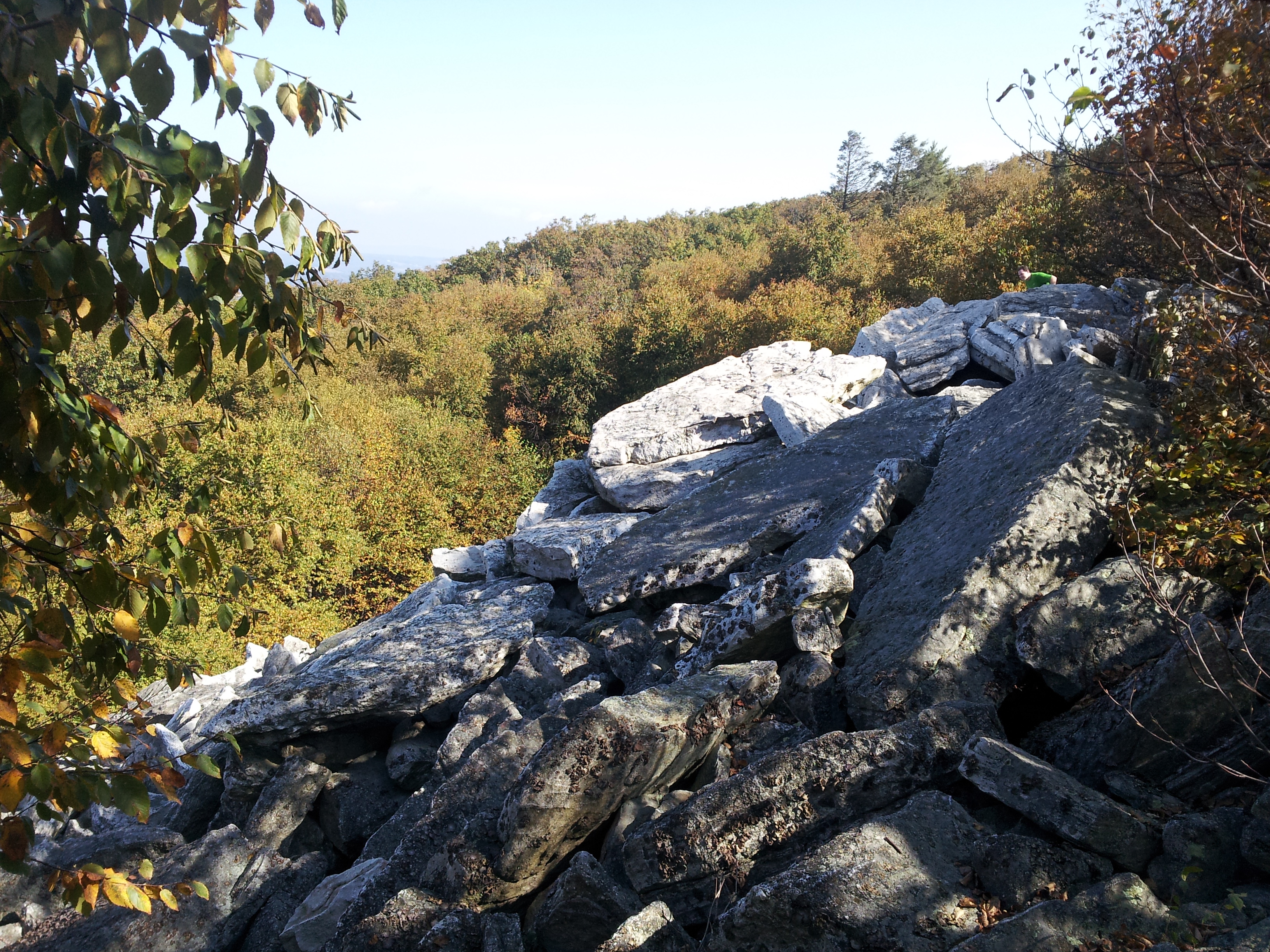
This is the highest elevation at Hawk Mountain, and there are expansive views to both the north and south (the only overlook on the mountain with a view in both directions). It is the best point for birdwatchers to view the raptor migrations, and is constantly bustling. The eastern edge of the boulder pile marks the beginning of the Skyline Trail which runs along the top of the Kittatinny Ridge, which is the northern boundary of the sanctuary. This trail begins with a very unsubtle 30-foot vertical drop:
The above photo is looking straight up from the bottom of the first drop (5). There are two more along the way and as well as a sharp descent along which the somewhat thin but thankfully sturdy trees are a big help for balance. Finally, the trail begins to level and, about halfway to the next trail, opens up onto a large pile of boulders:
The East Rocks (6) is more of a quiet, looming behemoth of near-solitude. Unlike the populated North Lookout, this area sees much less traffic, mostly due to the difficulty of the Skyline Trail. However, the birders would benefit from settling in here; we saw four or five hawks to the south on our way out, and during lunch we saw a golden eagle get dive-bombed by a kestrel. Both birds dropped below the tree line in the picture below. We assume the kestrel lost as only a few seconds later, the eagle emerged into view with the kestrel nowhere to be found.
As we continued along the ridge, a few glances upward through the trees revealed the same (or so we assumed) eagle using the ridge to fly directly above us, perhaps about 15 or 20 feet over our heads.
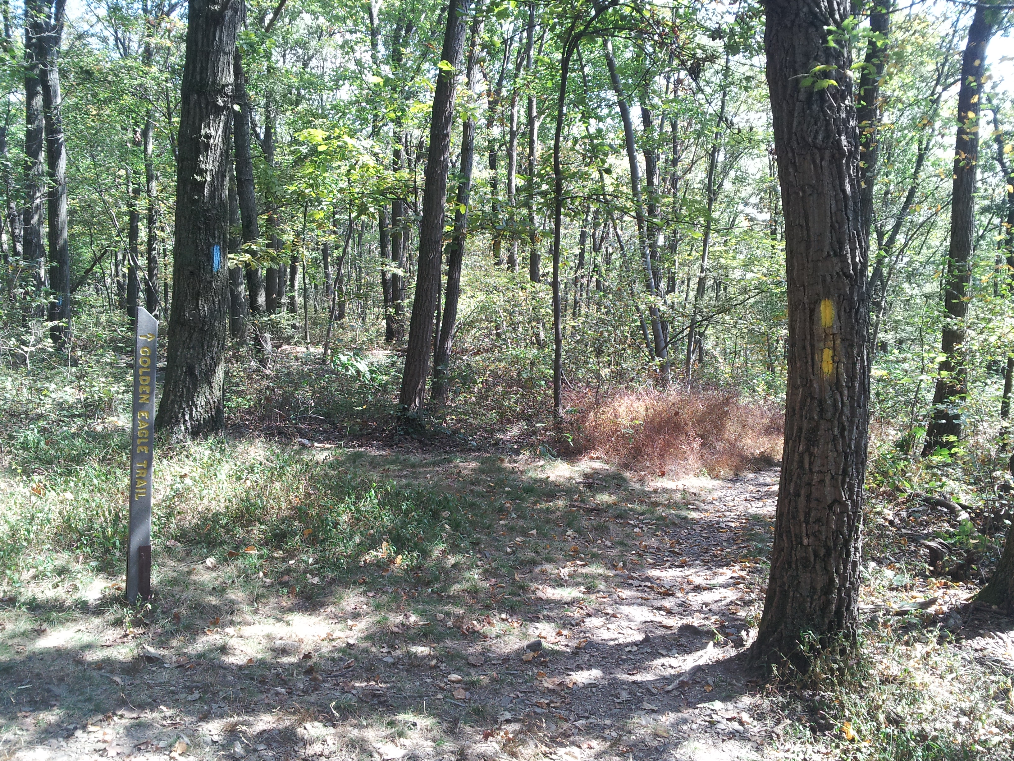
Eventually, we approached the junction for the Golden Eagle Trail (7), which would bring us steadily down the side of the mountain, but we passed that trail (for now) and continued to follow the Skyline Trail eastward past the sanctuary boundary and finally to where it intersected with the Appalachian Trail (8).
While relatively level, this section of the trail was considerably more sparsely travelled, and much more obscured by growth on the forest floor. Fortunately, the trail was well marked with sky blue blazes, but the overgrowth made avoiding the small ankle-bender rocks peppering the trail difficult.
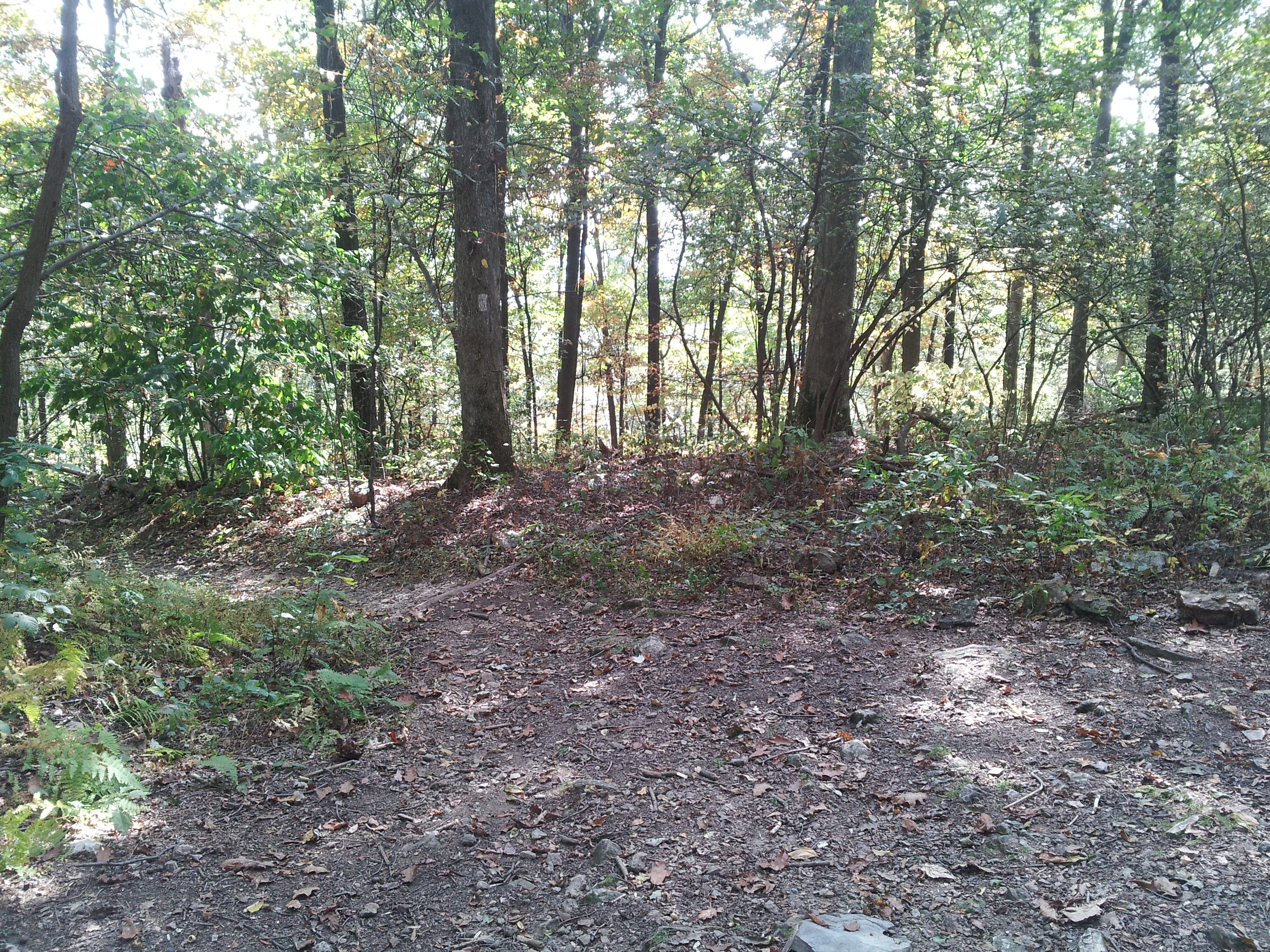
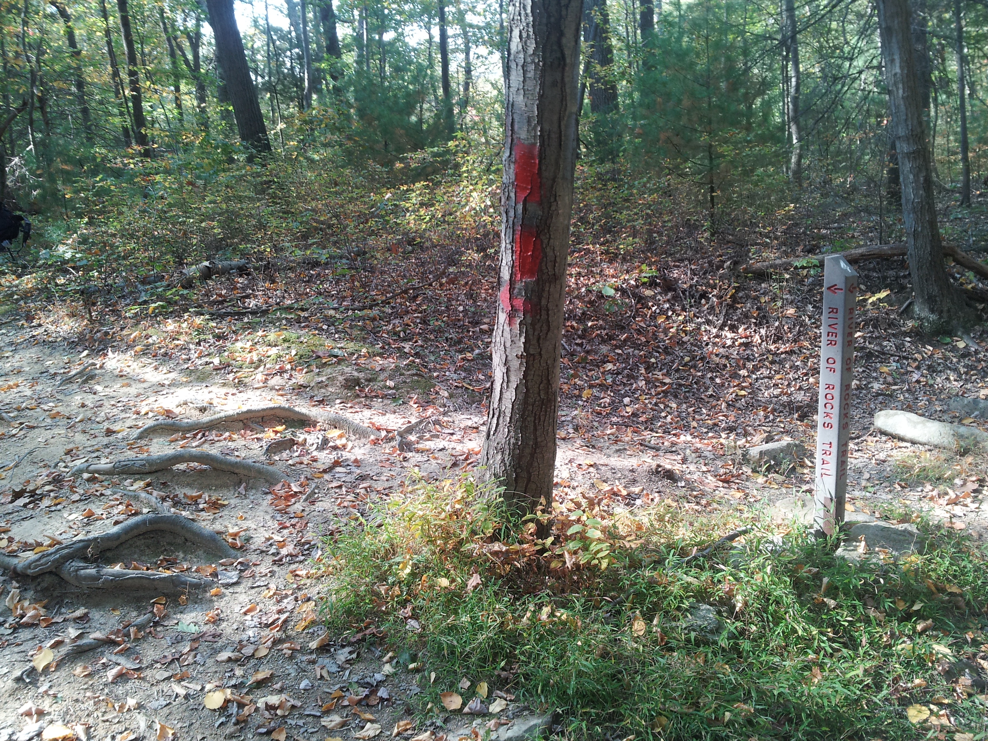
We returned to the Golden Eagle Trail and prepared for a nasty descent (though I know from experience that the ascent on this trail is a real bear and multiple times worse). Finally, we arrived at the bottom of the kettle in between the two large boulder fields that make up the River of Rocks. After a brief rest, we began the final segment along the lower portion of the River of Rocks Trail (9).
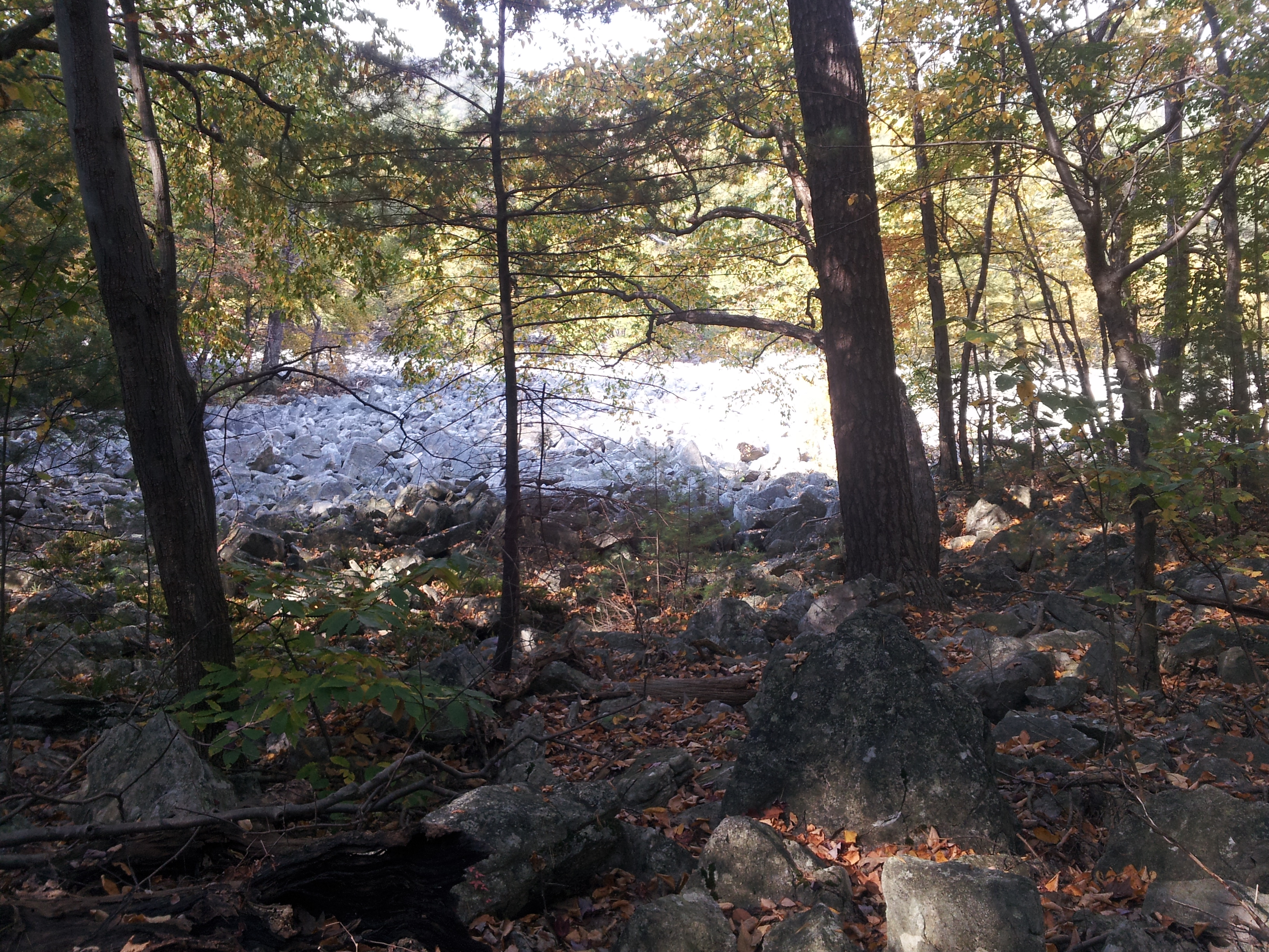
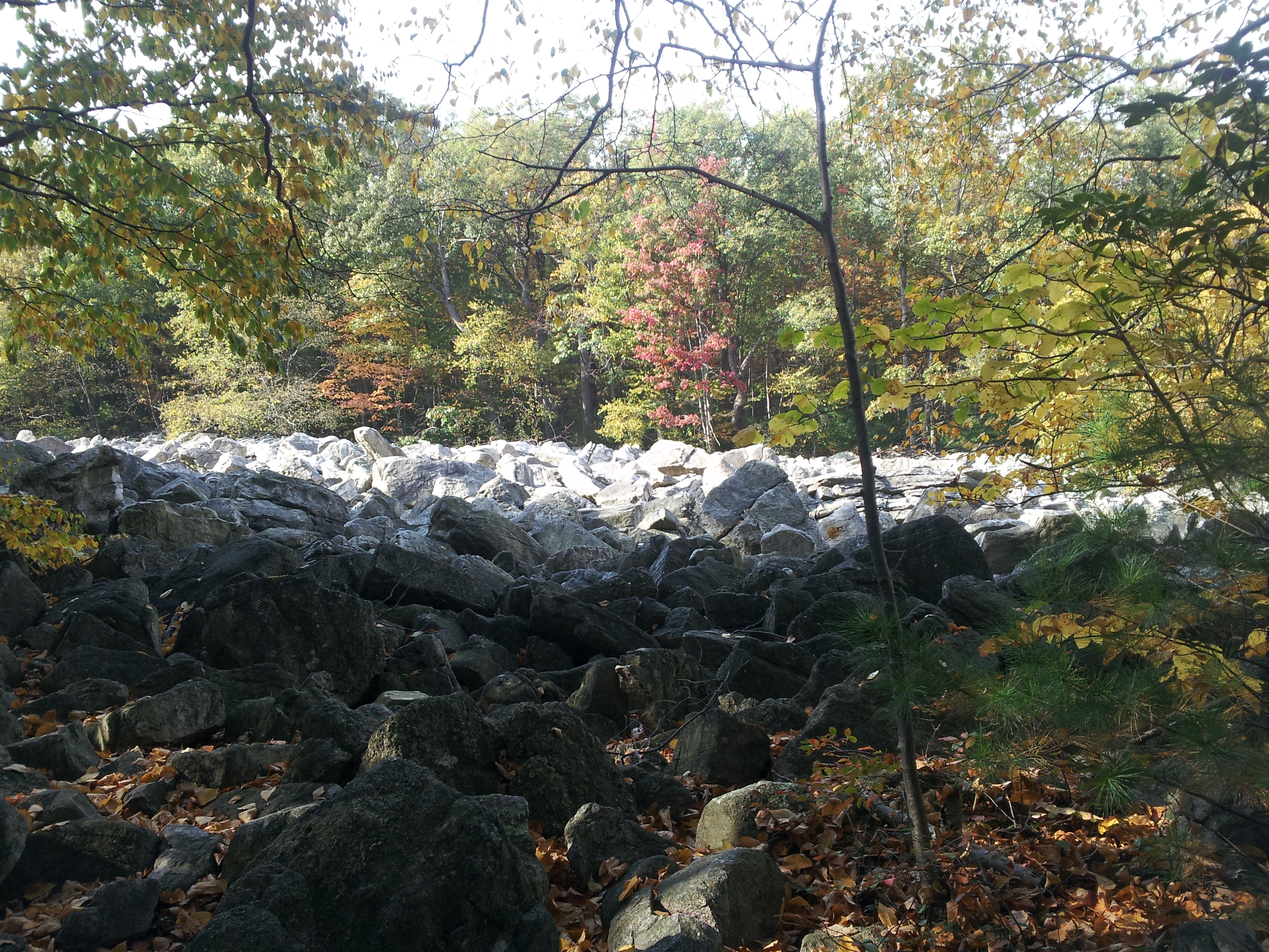
Along the way, we had some nice close-up views of the boulder fields (10):
Finally, we approached the final ascent toward the South Lookout. We had already been ascending for about a half mile but the grade was sufficiently generous. As long as we kept a reasonable pace and didn’t try to push the speed, it was manageable. But the last section from the southern tip as the trail turned to the northwest was much less forgiving. By the time we arrived at the visitor center around 4:30, we had hiked over six miles, averaging about 1 mph. According to the GPS tracking app I was using, we spent under 30 minutes idle (not counting our stop at the East Rocks for lunch).
I was accused by Darling Wife of overexerting myself. I won’t disagree, but I won’t agree either. Upon the conclusion of the day, my legs wanted to fold themselves up and go into storage, and over the next couple days, I was sore in places I forgot existed. However, this was to be expected. After all, these trails are not easy, and a steady ascent for the second half of the final mile means no relaxing until the hike is officially over.
The sanctuary officially recommends that our route be travelled in reverse. It makes sense…with the exception of the ascent via the Golden Eagle Trail (which knocked me on my rear when I was in much better shape almost two decades ago), the recommended route poses much less challenge. The boulder drops on the Skyline are significantly easier to ascend (the descent is dangerous and inexperienced hikers could be seriously injured or worse), and the route ends with a descent (and potentially a leisurely one if the Escarpment Trail is avoided). But that seems counterintuitive to me.
I find the route we chose a better one as it forces me to persevere. There is no coasting, no autopilot. There’s a more significant sense of accomplishment after that final push on the ascent to the South Lookout, and the definitive relief of crossing entering into the clearing, emerging from the trail, and having a definitive knowledge of finality and success–there’s meaning in that. We all too often take the descent in our lives, and turn on the autopilot and just coast. There’s no accomplishment in that, no betterment, no success. I’ll take the soreness any day–it’s a reminder of what was undertaken.
For more information on the HMS orgainzation: www.hawkmountain.org
For more information on this particular trip: Fab Hub’s Hike
Love this? Share the love and tell someone!

6 Comments
Comments are closed.
Great pictures! I love to go hiking, myself, but I have never gone on that long of a hike before. Getting out into nature is a great respite from the “real” world.
Neither have I! That was all the Hub and his friend. Kidzilla and I were home snuggled under blankets reading books. 🙂
And you’re right – it is a definite retreat.
Those are great pictures. It reminds me of the last time I went hiking. That was a while back. I went with some friends out into the woods and we hiked a trail in Northern Minnesota. It was so peaceful and calm. I remember we came across some bear droppings so we knew that they were out there somewhere. I wish we would have heard one or I could have saw one.
Uh, really? I’m thinking if I were in the woods and heard or saw a bear, I’d have left droppings of my own.
looks amazing! i love hiking but have not gone a single time since having my son almost 2 years ago. now I am itching to go!
We did a LOT of that not doing things lifestyle after Kidzilla was born. Now that she’s older and more functional, it’s great fun to take her places. We had her to the mountain for her first hike a year ago and she took to it like a duck to water. Obviously, we don’t take her anywhere near where her Dad goes, but she loves the trails that are her speed.